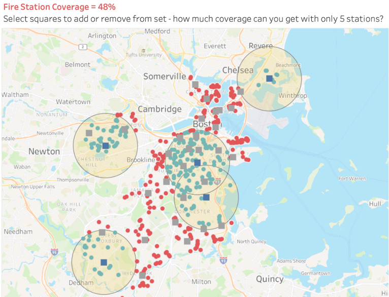
Explore the world of geospatial analysis with this post by Zach Leber on Tableau’s community forum. This article provides a deep dive into how spatial sets can be utilised to conduct intricate distance analyses within Tableau. Whether aiming to refine your understanding of spatial relationships or tackle complex distance metrics, this guide is designed to help you achieve precision and clarity in your analyses.
By reading on, you’ll gain valuable knowledge on employing spatial sets to address multifocal distance challenges – empowering you to create more nuanced and informative visualisations. Zach’s post not only highlights advanced techniques but also provides examples that demonstrate how these methods can be applied to real-world data scenarios – equipping you with the tools and insights needed to elevate your data projects.